-
Telford "Unusual Weather" Blog


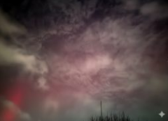
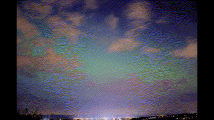
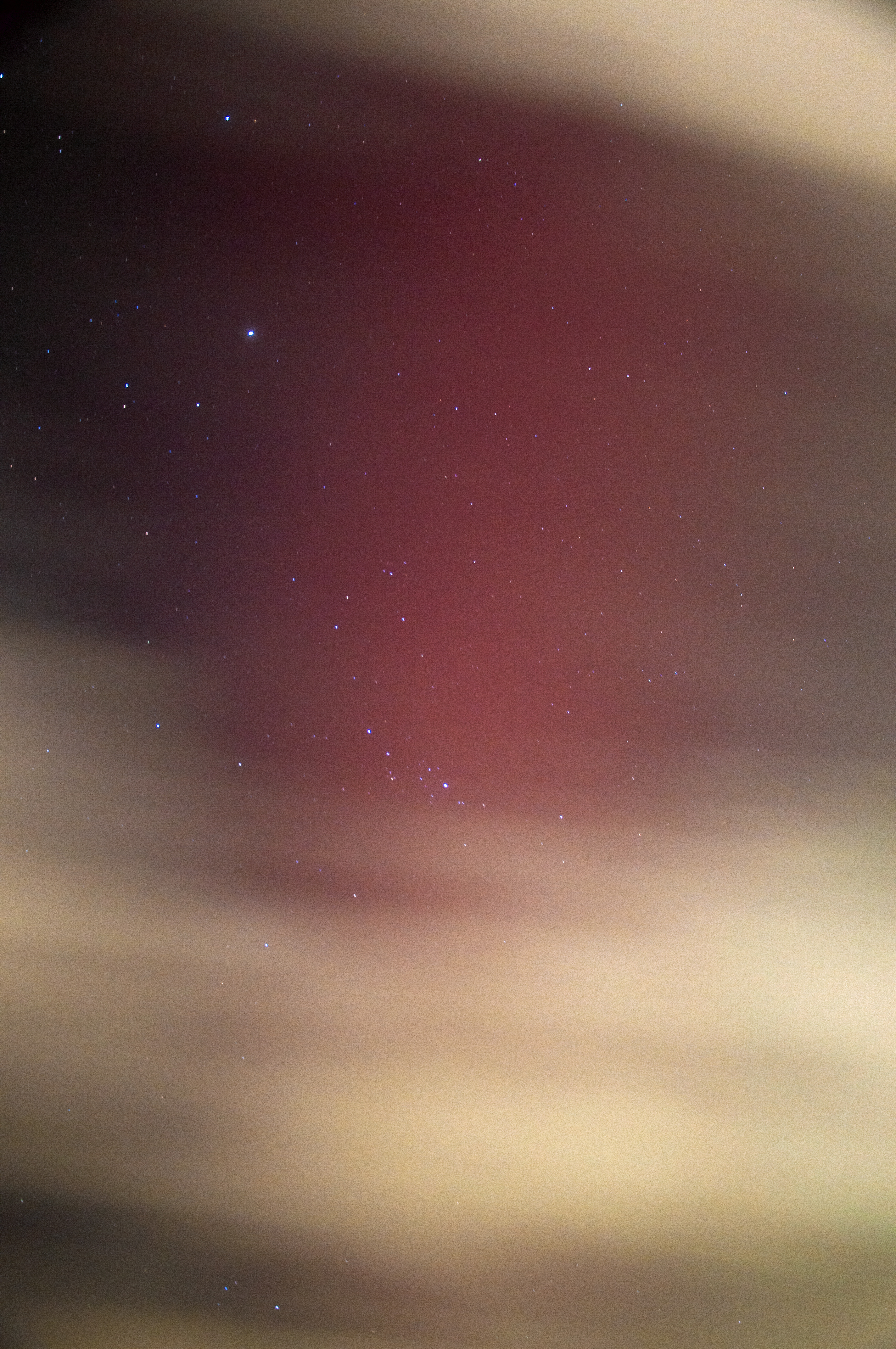
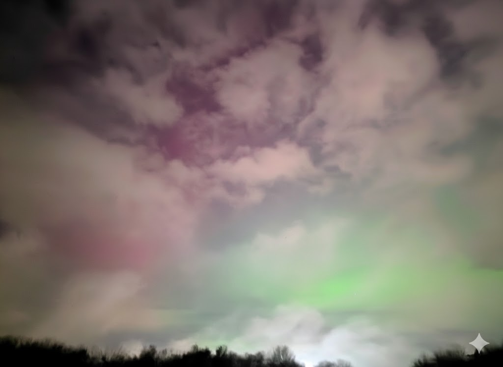
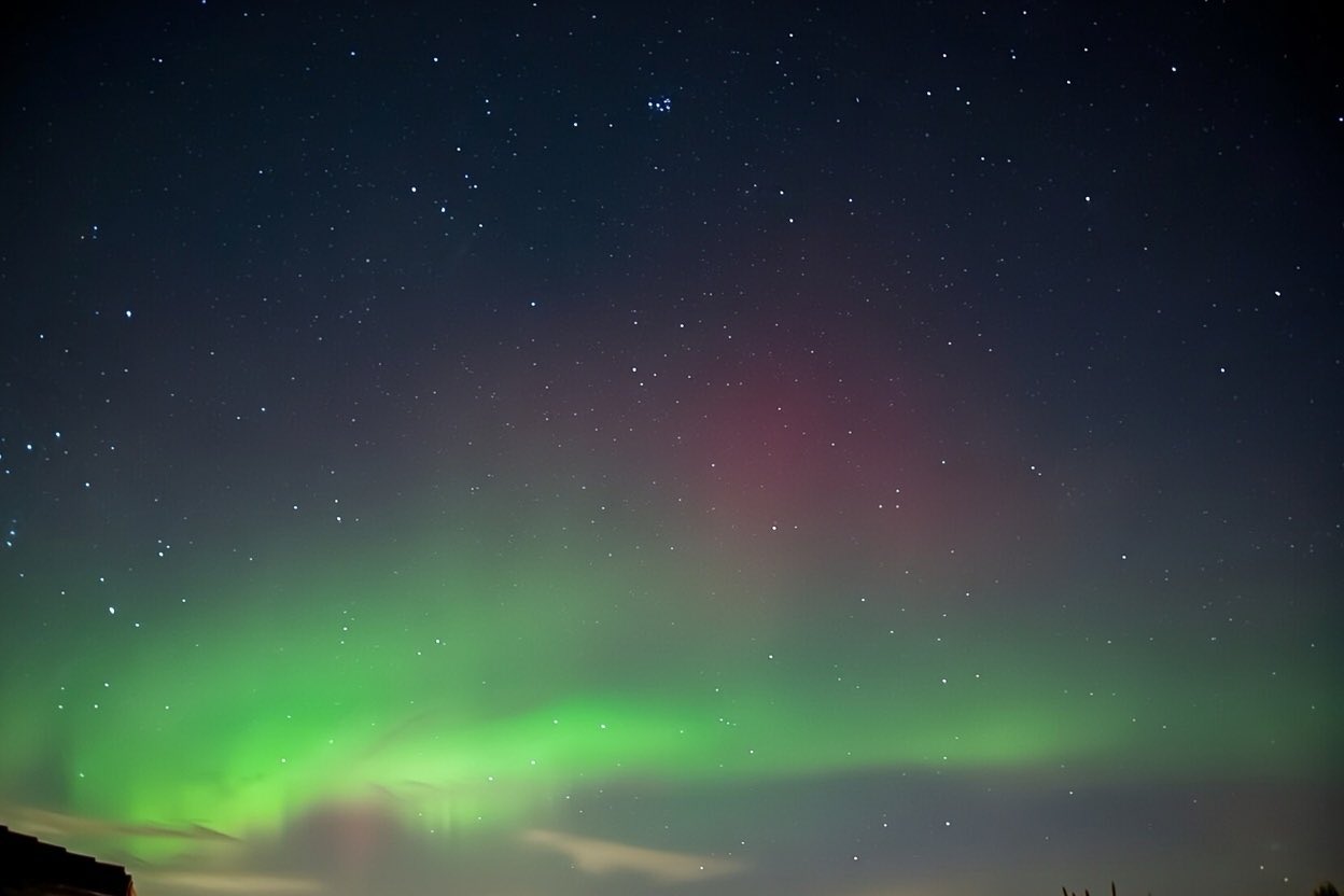
Date Type Value Comment 22-26-June-2026 Heatwave ~33c+ New June heat record set in England 25/6-May-2026 Heatwave 30c+ New May heat record set in England 19-Jan-2026 Aurora Easily visible when clouds parted This geomagnetic storm follows a series of major aurora events over the last couple of years. Unlike earlier storms, it was caused by a single ~X2 flare and CME accelerated by an ongoing coronal hole. Heavy cloud limited visibility (on 19th, impossible on 20th) in Telford with some of the briefest gaps in the clouds giving rise to some dynamic photo compositions
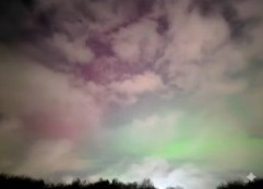
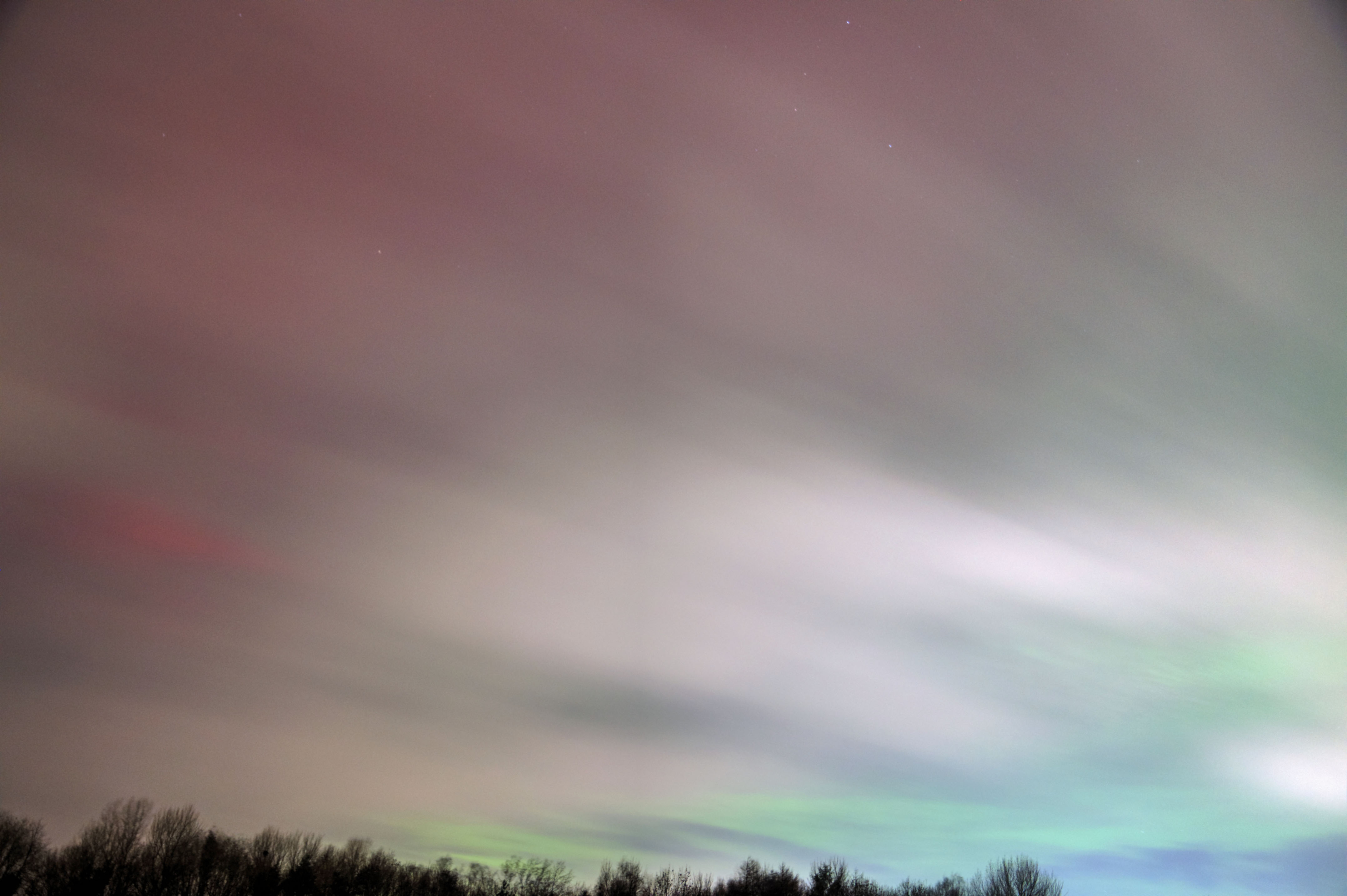
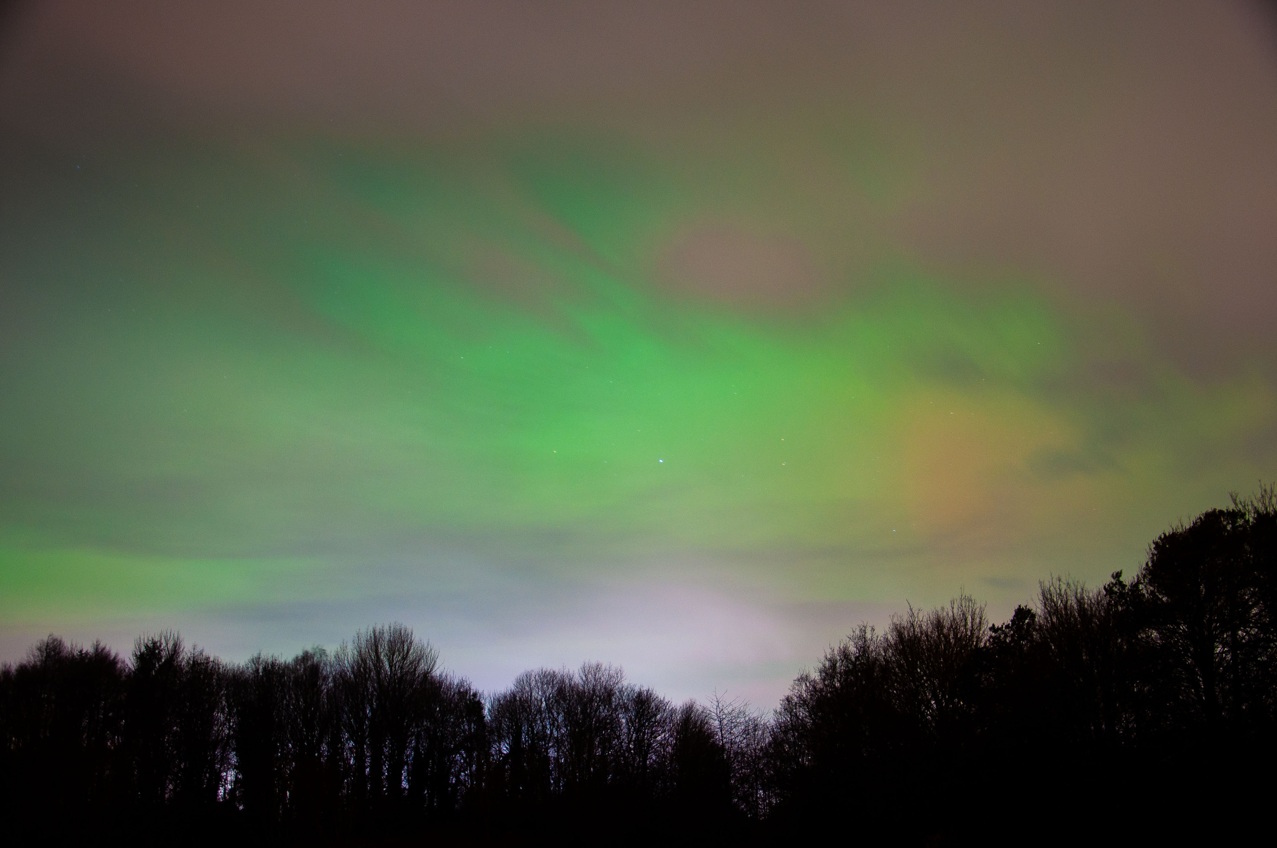
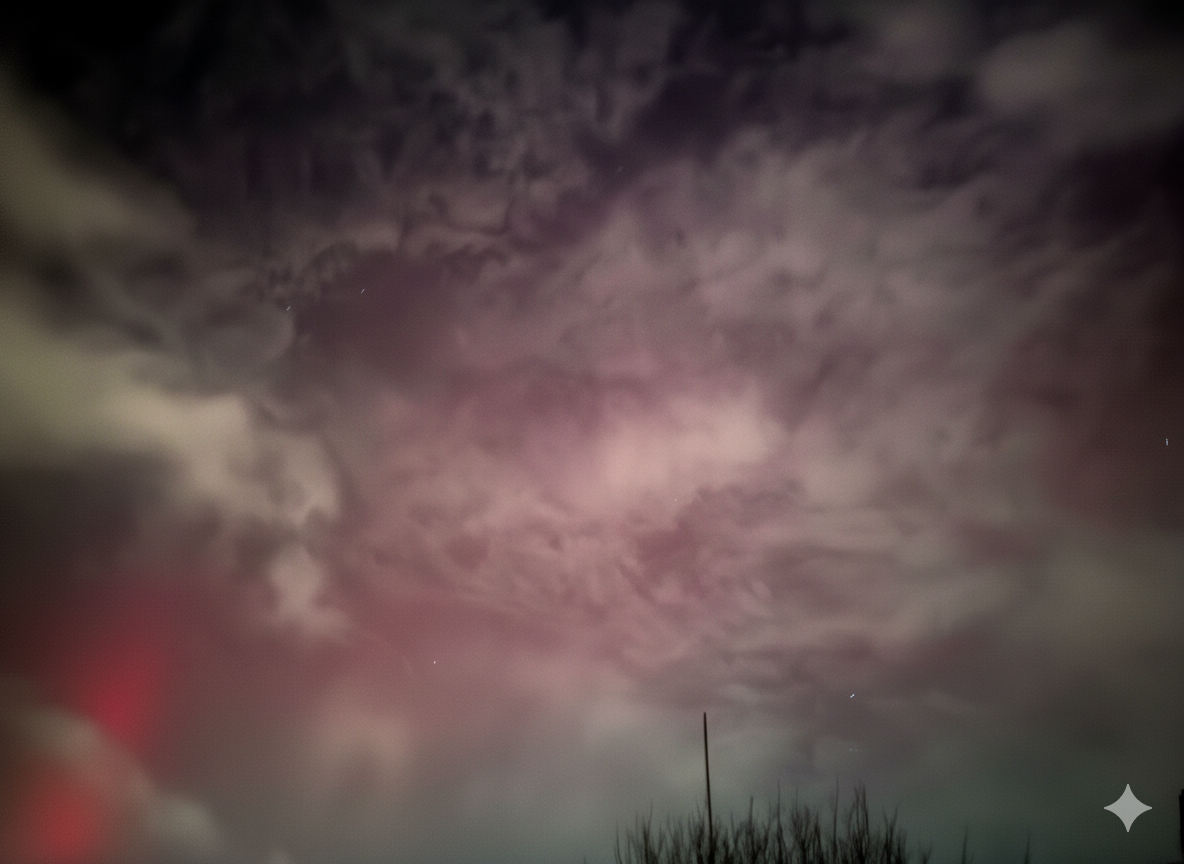
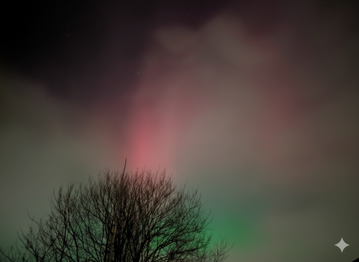
Here's an image of the aurora taken on January 19th (large images below). It's not perfect, but it's notable since it appeared due south from my location, something I hadn't seen before, highlighting how strong and rare the geomagnetic storm was.

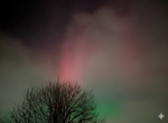
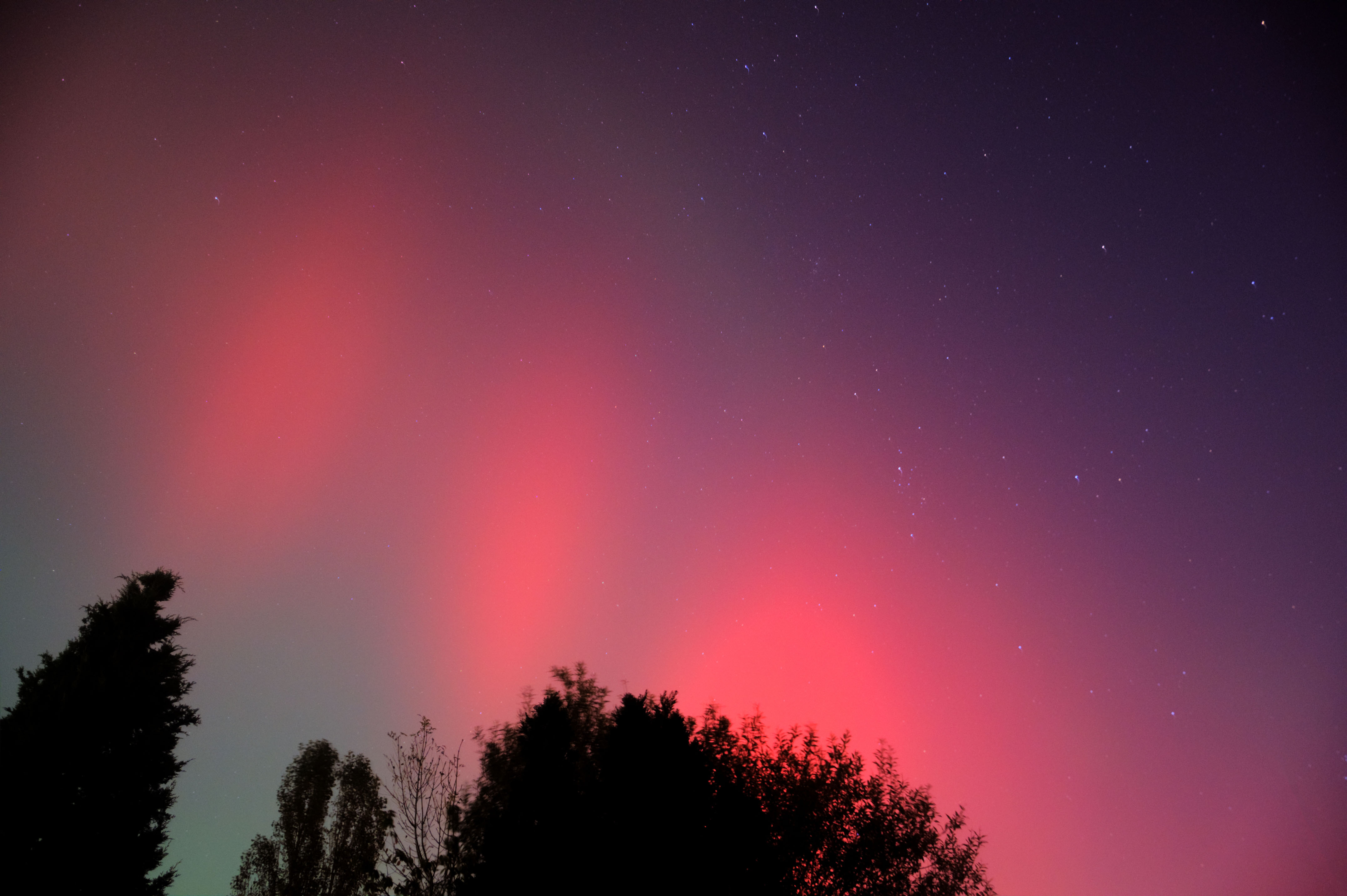
Grok cleared the cloud cover for me; see the below comparison
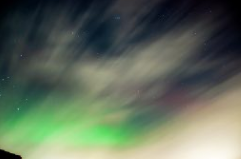
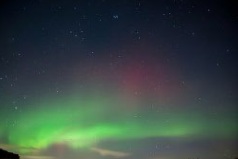
Grok Imagine prompt: Remove cloud cover and preserve both the green and red aurora
08/9-Jan-2026 Snow 14cm Major snow event driven by Storm Goretti 02-Jan-2026 Snow 3.5cm 2025 2025 2025 2025 Summer 2025 Hot & Dry 34c The summer consisted of 4 distinct heat waves including a top temperature of 31c in Telford on 12th August
16-Apr-2025 22:10 Aurora Visible A brief bit of a purple in the Northern sky
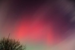
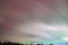
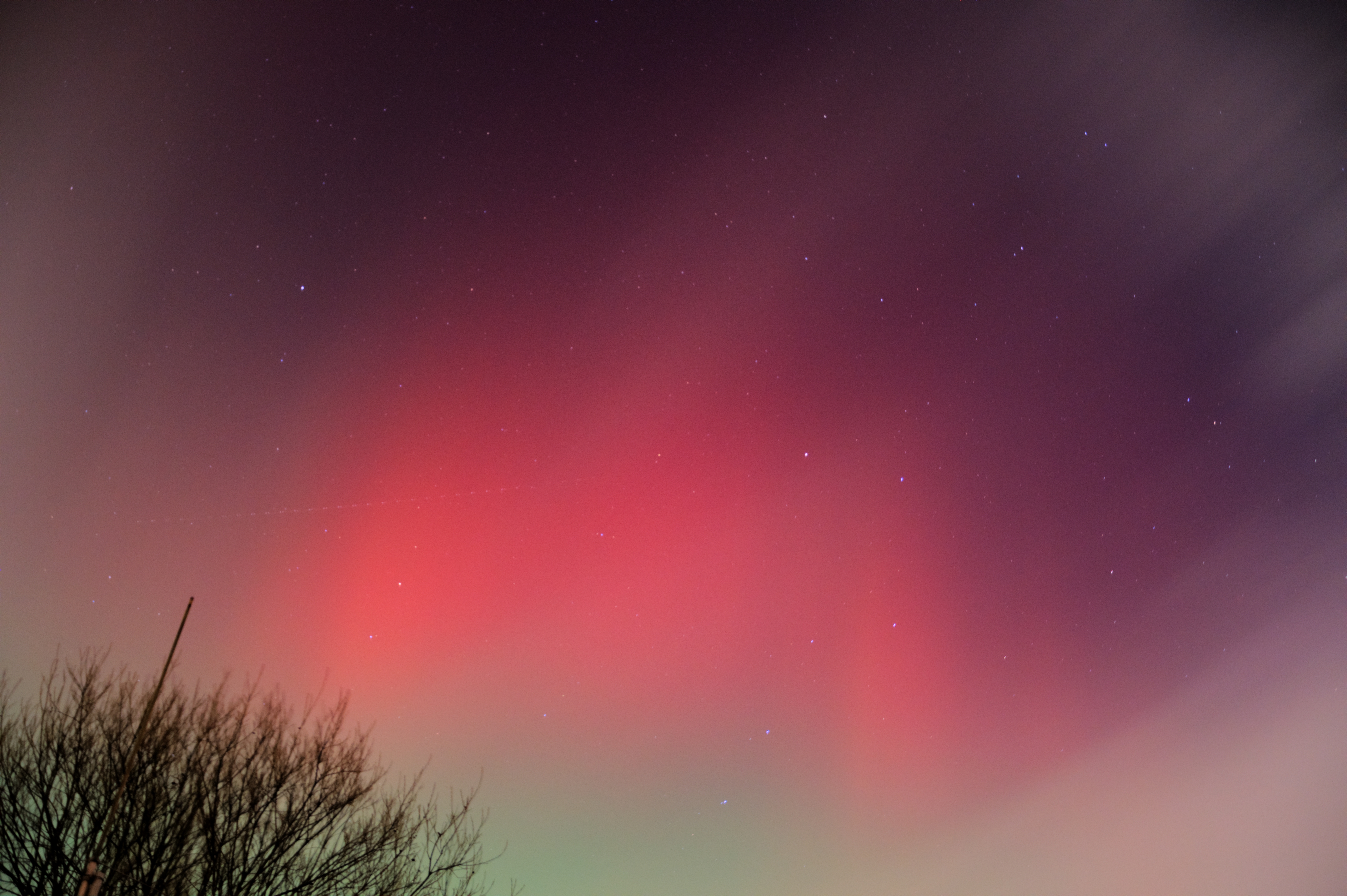
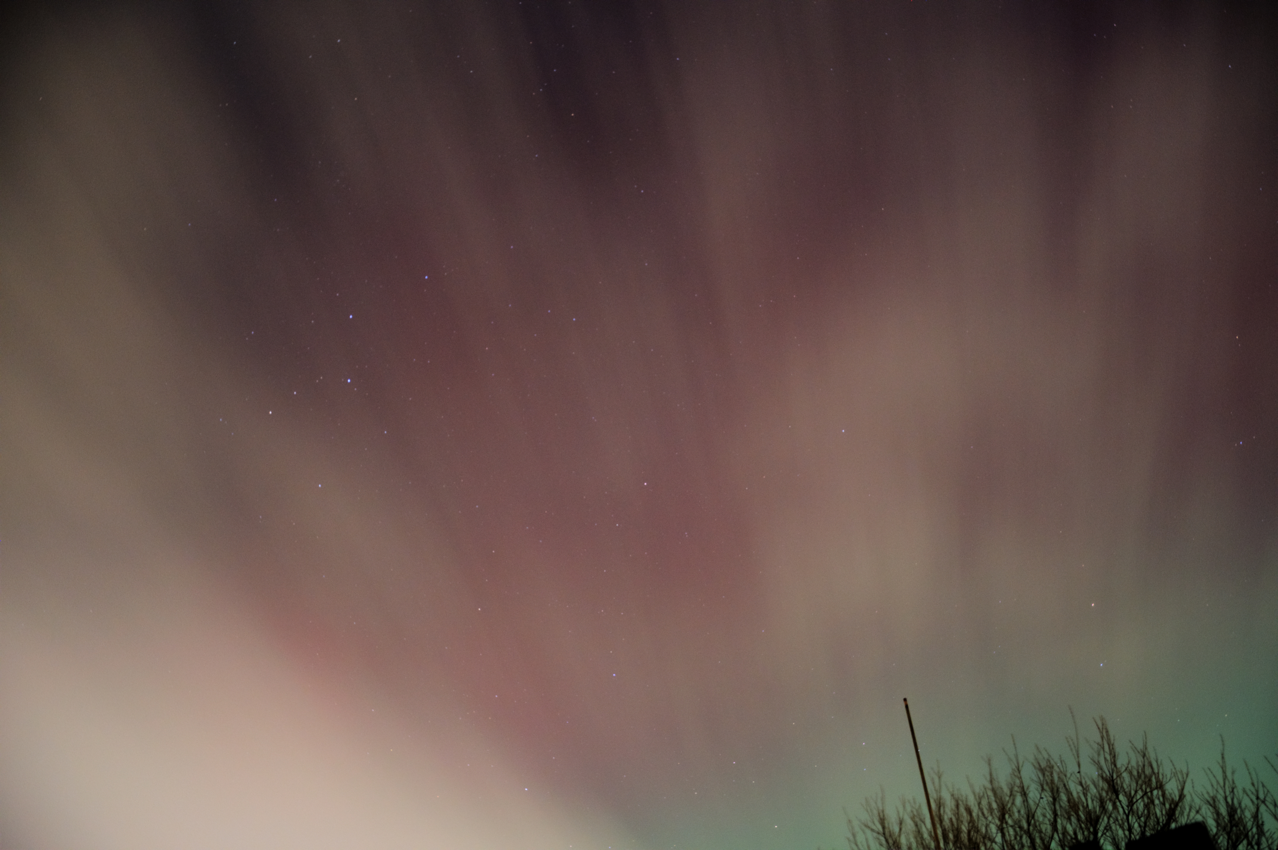
24-Jan-2025 Wind 67mph Storm (Hurricane) Eowyn had a peak gust of 67mph recorded at Shawbury and slammed into Ireland and Scotland with a devasting sting jet wrapped into the low pressure system, causing extreme winds 05-Jan-2025 Snow 3cm 04-Jan-2025 Snow 3cm 01-Jan-2025 Aurora Super Visible / Naked Eye (But Brief) A brief (~1 hour) but very intense aurora display occurred on the 1st of Jan 2025 at 17.30 in Telford / UK. This display was easily visible to the naked eye showing the magnetic field lines of red with a deep red background to the north. As usual the camera (both SLR and Phone) picked up way more colours and details than those visible to the naked eye, as shown below:


As well as the aurora to the North there was (unbelievably again) the Stable Auroral Red (SAR) arc running overhead from west to east, although I did not have chance to photograph this, this time (I was too busy photographing the main display), the arc was visible to the naked eye and looked very much like the same phenomenon I captured previously HERE and HERE during the 2 big events of 2024.
As I understand it a SAR is the glowing of the electric ring current around Earth which is supercharged by the aurora / solar wind. It’s both an aurora event and not an aurora itself (different physics)
2024 2024 2024 2024 27-Dec-2024 Fog n/a Wrekin above the Fog 
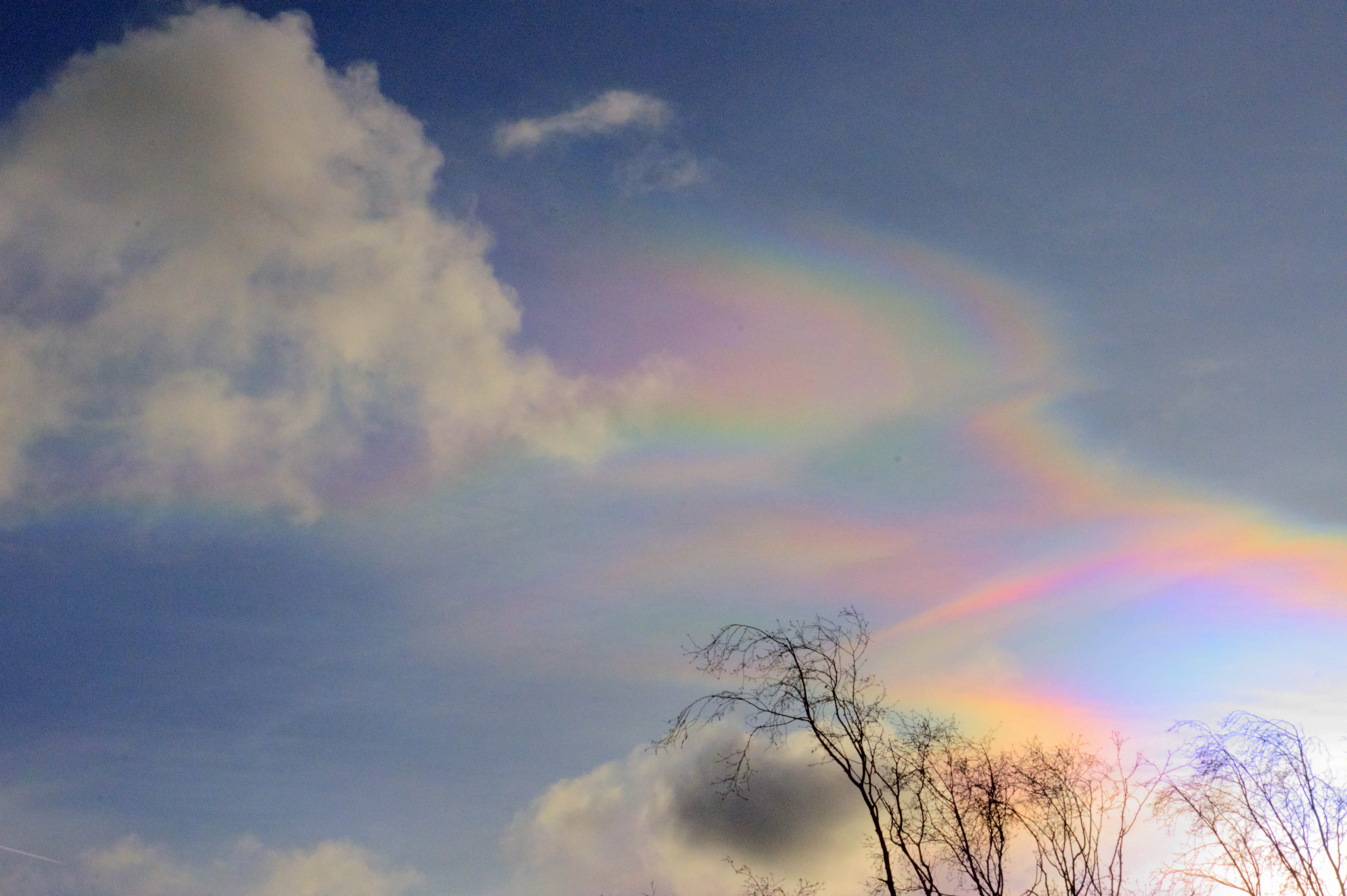
26-Dec-2024 Fogbow n/a A Fog Bow in Telford 
25-Dec-2024 Jellyfish n/a A Jellyfish (Virga) Cloud in Telford 
20-Nov-2024 Snow 4cm 19-Nov-2024 Snow 7cm 10-Nov-2024 Anti-Cyclonic Gloom Visible Today marks the end of 2 weeks of no sunshine also known as anti-cyclonic (high pressure) Gloom
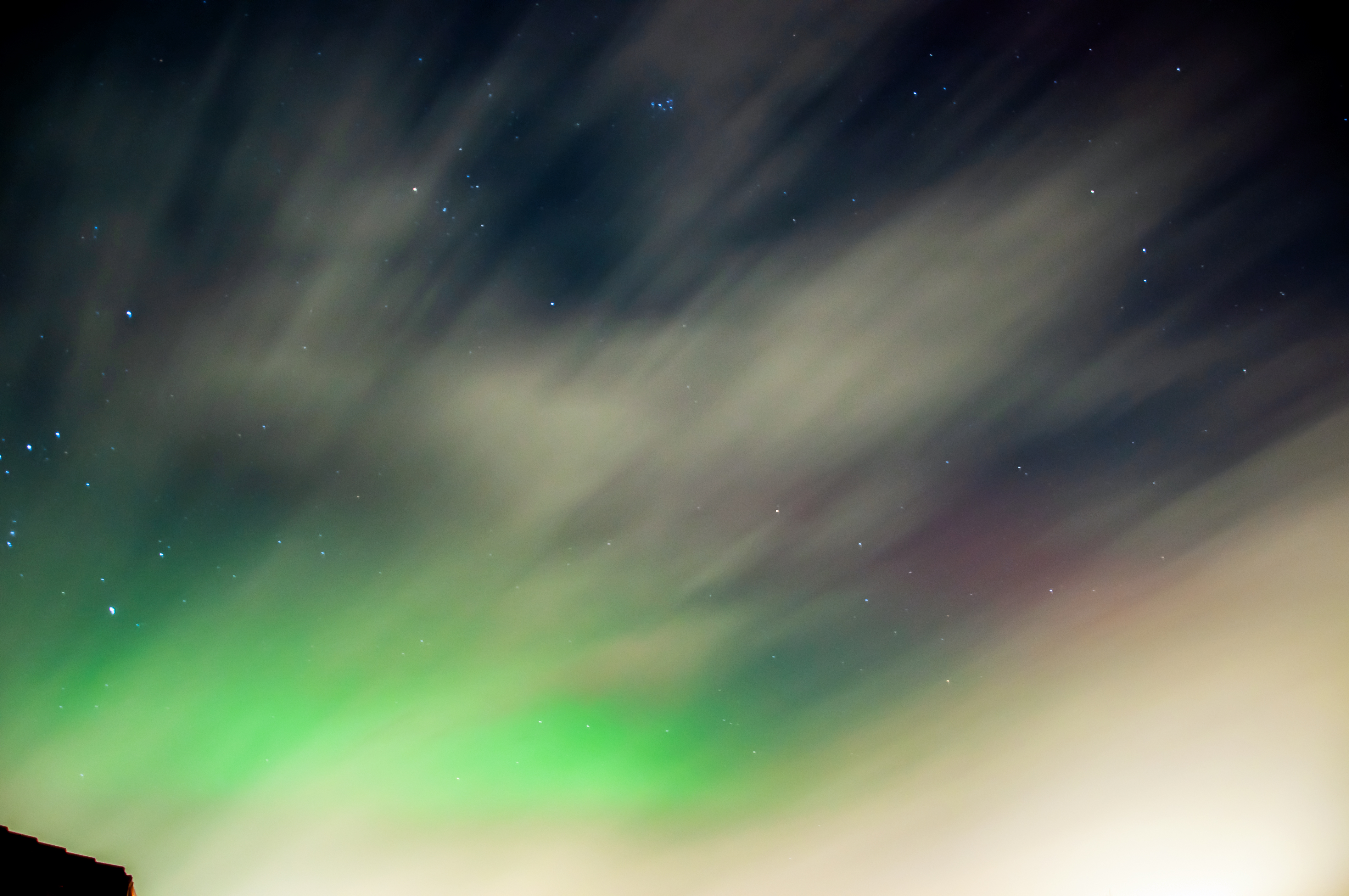
10-Oct-2024 Aurora Super Visible / Naked Eye The was the 2nd major geomagnetic storm of 2024 and this aurora event did not disappoint. The event was on a par with the May 10th event having an overhead aurora corona; a constant green arc (for hours) with red and purple curtains and even an orange (which I understand is a visual mixing of Oxygen elements at different altitudes, i.e. combining of the colours red and green). This aurora did not have any blue (Nitrogen) colours unlike the May 10th event. This was indeed an historic event with (much like the 10th May event) a crystal clear sky, minimal impact of light from the low hanging moon and oodles of multi coloured aurorae for all of the UK to enjoy.


13-Sep-2024 Aurora Visible A few vertical purple pillars above the horizon
18-Aug-2024 Smokey Sunset 
The sunset tonight in Telford looked like something out of the Star Wars Tatooine scene with the deep red colours through the Smokey haze a complete 1/2 hour before sunset. The dark smudge on the right-hand side (middle latitude) of the solar disc I believe is sunspot 3784 which was responsible for a brief geomagnetic storm yesterday. The moonrise was also a deep orange and a very special event to view
12/13-Aug-2024 Aurora Visible 
The vertical pillars (sweeping in from the left) were visible to the naked eye
12-Aug-2024 Aurora Visible 
10-May-2024 Aurora Super Visible / Naked Eye This aurora / northern lights event will go down in history as one of the most easily viewed in the UK (of modern times). The G5 (KP9) storm was brought on by a conveyer belt of 6 X-class solar flares of which the 1st few disturbed earth's magnetic field so severely that it caused an aurora corona to form over the UK resulting in overhead (not to the north) multi-coloured displays to the delight of many aurora watchers around the UK and beyond. My photos from Telford are below:


The following photos are taken with / from my phone as opposed to my DSLR. As you can see from the pictures my phone camera was able capture way more of the aurora (than the DSLR), in a single frame. (albeit at a reduced resolution).


Download a large (16MB) panoramic of the aurora as visible over Wellington, Telford.
Camera settings used:
My Nikon D90 DSLR had the exposure set to 30 seconds with an ISO of 640 and a F stop of 3.5 on a fixed camera stand.
My Google Pixel phone was on night vision (handheld) and exposed for a mere second or 2
I also made a GIF of the Aurora Corona
16-Apr-2024 Aurora Visible 
Another decent showing of Aurora, although not as impressive as the thick green aurora arc that was visible on Shetland Webcam 3, at the same time
2023 2023 2023 2023 21-Dec-2023 Nacreous Visible
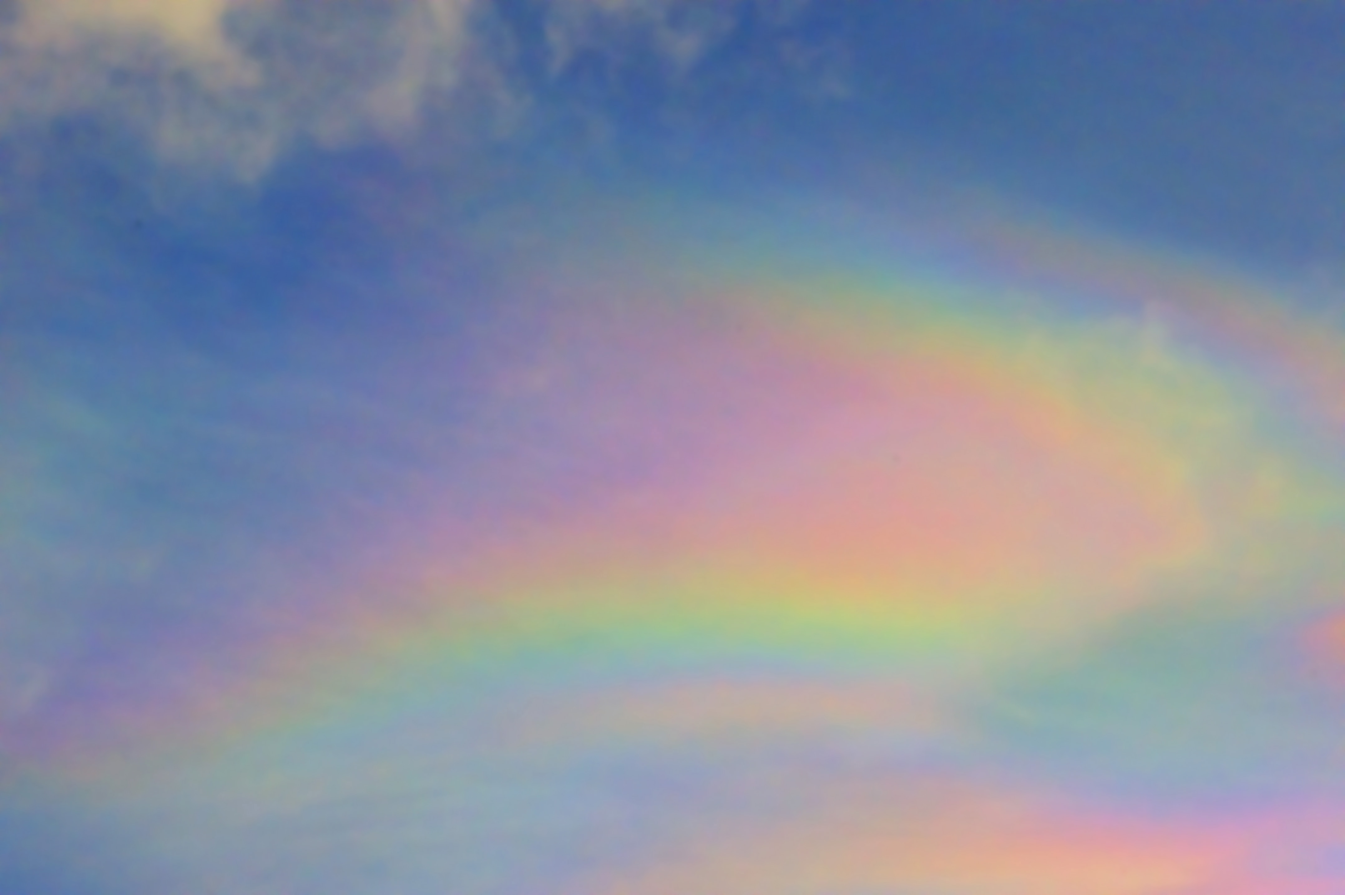
The rare weather phenomenon of nacreous "mother of pearl" clouds were visible over Telford on this day. Nacreous clouds are caused by high altitude ice crystals in the atmosphere scattering the light into "pearl like" rainbows
05-Nov-2023 Aurora Visible 2023 continues to be an amazing year for seeing the aurora in England

07-to-10 Oct-2023 Temp Peak 23c Very warm for October 18-Sep-2023 Aurora Visible A purple haze was visible towards the northern horizon 05-to-09 Sep-2023 Temp ~27c After a disappointing summer of weather September surprised us with an unprecedented heat wave with 5 days of lovely sunshine and temperatures around 27c 23-Apr-2023 Aurora Visible behind the clouds I'm sure it was wonderful above the clouds 23-Mar-2023 Aurora Visible 
The bright red vertical column at the end of the video was visible to the naked eye
10-Mar-2023 Snow 11cm 
23-Feb-2023 Aurora Visible 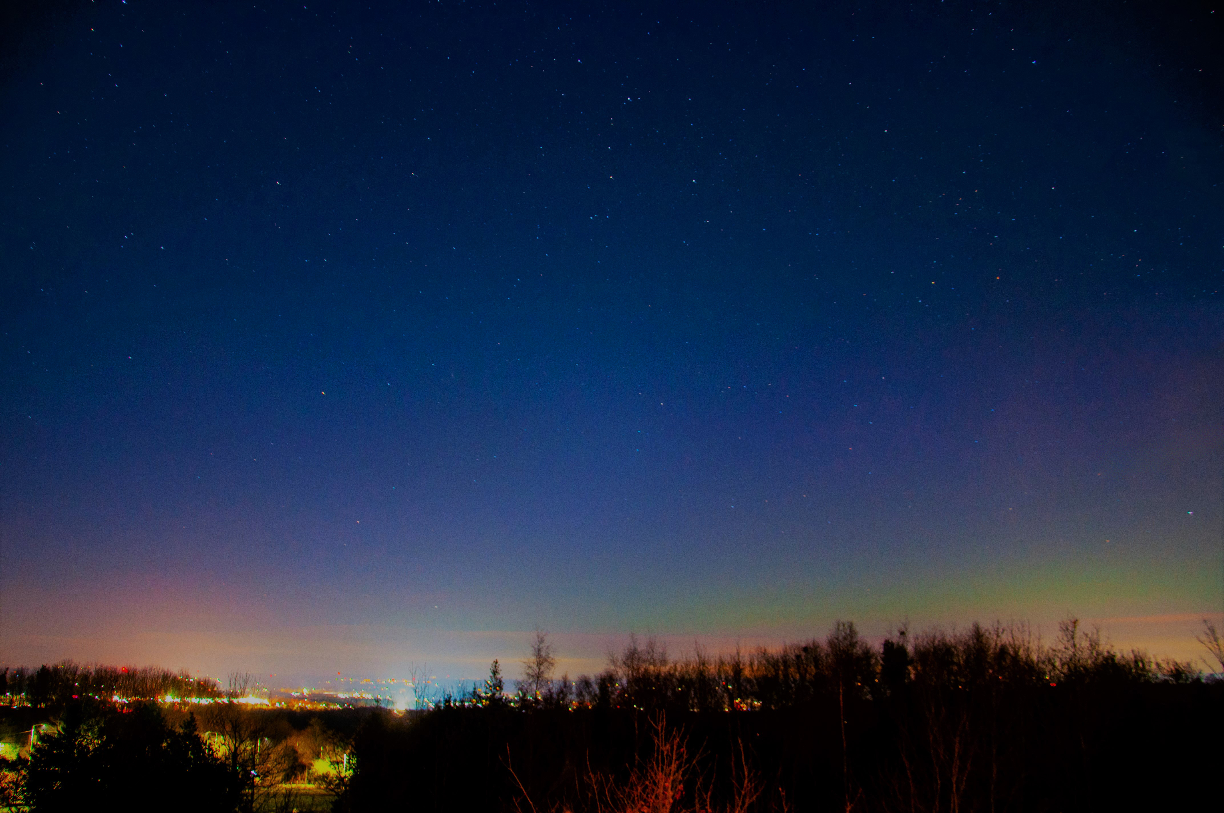
2022 2022 2022 2022 10-to-14 Aug-2022 Temp 30c+ 2022's second (but more prolonged) heatwave with daytime temperatures in Telford above 30c for 4 days, peaking at 32c 19-Jul-2022 Temp 35c+ Shropshire (35c+) and the wider UK (40c+) record new temperature records during a short but intense period of very hot weather. 18-Jul-2022 Temp 35c+ Hot Weather 2021 2021 2021 2021 19-Dec-2021 Fog Inversion 
This video is taken from the top of the Wrekin showing the rolling fog below, very atmospheric and only the 2nd time I’ve seen this.
16-to-22 Jul-2021 Temp ~30c 6 day Heat Wave 2020 2020 2020 2020 12-Aug-2020 Temp 31c Hot Weather 31-Jul-2020 Temp 32c Hot Weather 10-Jul-2020 Clear Comet Neo Wise 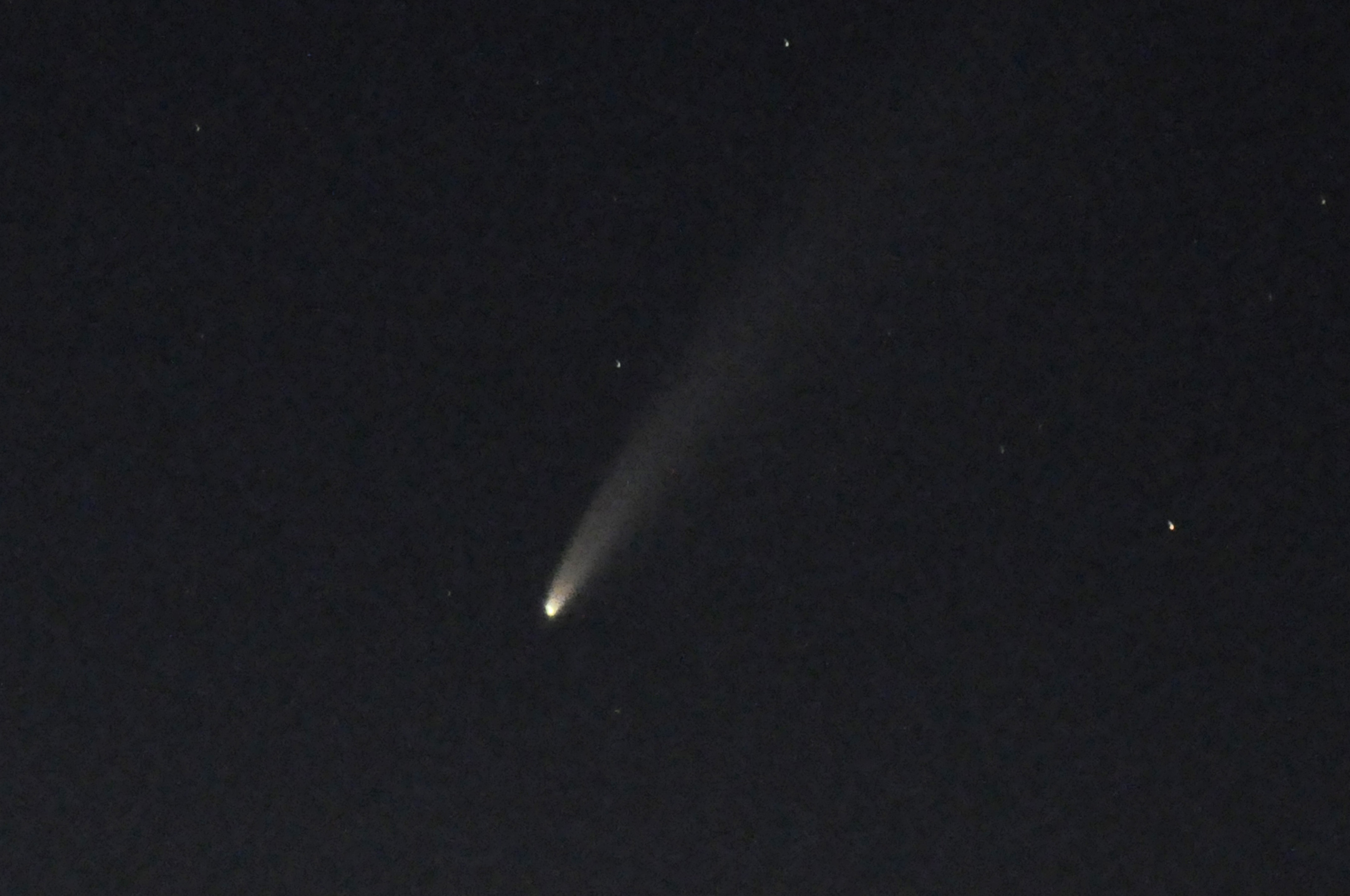
09-Feb-2020 Storm Ciara 60+ Mph Gusts UK wide storm - Page 1 Page 2


